Sign In


Canopy Roads Management Plan Goals

View the Canopy Road Master Plan


Vision and Purpose of the Canopy Roads Management Plan

The Canopy Road Management Plan will increase awareness, preservation, and enhancement of the environmental and cultural benefits of the canopy roads through education, community engagement, and partnerships. Guiding development projects to include innovative solutions for preservation and enhancement of resources as well as protecting and enhancing a recognized environmental, cultural, and historic resource. All the while providing users a varied and immersive experience that goes beyond motorized access.
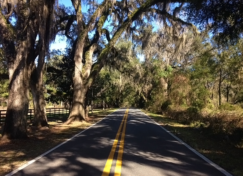
 

Goal 1: Educate and Engage the Community in the Canopy Roads Experience

Canopy Roads Master Plan Goal One

The Canopy Roads Management Plan shall be community driven and administered through partnerships to identify and achieve common goals and shall offer residents and visitors an enriching experience.

Implementation
Citizen Engagement
  • Get in on the conversation! The Canopy Roads Citizens Committee discusses implementation of the management plan at their public meetings. Meetings are held the third Wednesday of every other month at the Renaissance Center, 2nd floor conference room at 5:30 pm. Also, stay tuned for other public engagement efforts and events, which will be posted on the Community Engagement Calendar at Community Engagement Spotlight.
  • Does your group want to learn more about canopy roads? Please email the Planning Department.


Placemaking Plans

Ensure coordination with new and existing Placemaking plans.


Website
  • Created a Self-Guided Tour feature map in partnership with Tallahassee-Leon County GIS.
  • Updates to management plan implementation will be added to the Planning Department website on an ongoing basis.


Educational Materials

Created an informational brochure to educate and assist landowners with meeting canopy roads regulations.    


Goal 2: Guide Development Policies that Protect, Improve, Enhance, and Expand the Canopy Roads Experience.

Canopy Roads Master Plan Goal Two

Maintain the character of the canopy roads through responsible development practices that preserve, enhance, and improve the canopy roads.

Implementation
Design Manual

The creation of a design manual recommending treatments for features along canopy roads is in progress.


Comp Plan Updates

Ensure coordination with Comprehensive Planning updates


Goal 3: Preservation and Enhancement of Intrinsic Resources

Canopy Roads Master Plan Goal Three

Maintain the character of the canopy roads through preservation and enhancement of existing intrinsic resources. Most importantly, this includes the trees and vegetation that provide the stunning shaded canopy over and along the road, but also includes scenic view sheds and historic places and structures that contribute to the experience.

Implementation
Intrinsic Resources

A canopy roads quality rating system was developed by the committee early after its formation in 1993 and resulted in a paper map. This is currently being converted to a GIS based mapping application and will be updated as surveys are completed.


Enhancement Program
  • Staff is available to assist with creating a plan to enhance and improve the CRPZ on your property, please email the Planning Department.
  • Potential to partner with IFAS and Master Gardeners in progress.


1000 Trees

Support Leon County’s Strategic Initiative to plant 1000 trees along canopy roads. To date, 1,100 trees have been planted on canopy roads including Old Bainbridge Rd, N. Meridian Rd., and Miccosukee Rd.


Goal 4: Provide and Support Safe Non-Motorized Access while Preserving the Integrity of the Canopy Roads Experience

Canopy Roads Master Plan Goal Four

Safe alternative transportation opportunities provide economic benefits and increased quality of life. Supporting projects that provide connections to safe, non-motorized access to and between canopy roads provides users the ability to experience the canopy roads in multiple ways.

Implementation
Trail Connections

Support the initiatives in existing transportation plans and identify opportunities to enhance or install trail connections while preserving natural resources.

  • Trail crossing at Miccosukee Rd. and Feather Oaks, with connecting low impact trail from Arvah Branch Blvd.
  • Northbend Sidewalk installed at grade to minimize impacts along Centerville Rd.
  • Canopy walking trail in progress along Centerville Rd.
  • Pedestrian crossing in progress at Miccosukee Rd. and Dempsey Mayo Rd.


Promote Safety

Promote or enhance safety for users

  • Lighted trail crossing at Miccosukee Rd. and Feather Oaks.
  • Pedestrian safety options being considered at Miccosukee Rd. and Dempsey Mayo Rd.


Urban Forestry News Urban Forestry at Home Urban Forestry Tree Matrix